360° video to BIM-ready point clouds
Can a 360° walkthrough video replace a laser scanner for BIM? My master's thesis at Aalto University built the pipeline from video to metric point cloud and measured, without ground truth, how ready the result is for BIM modeling.
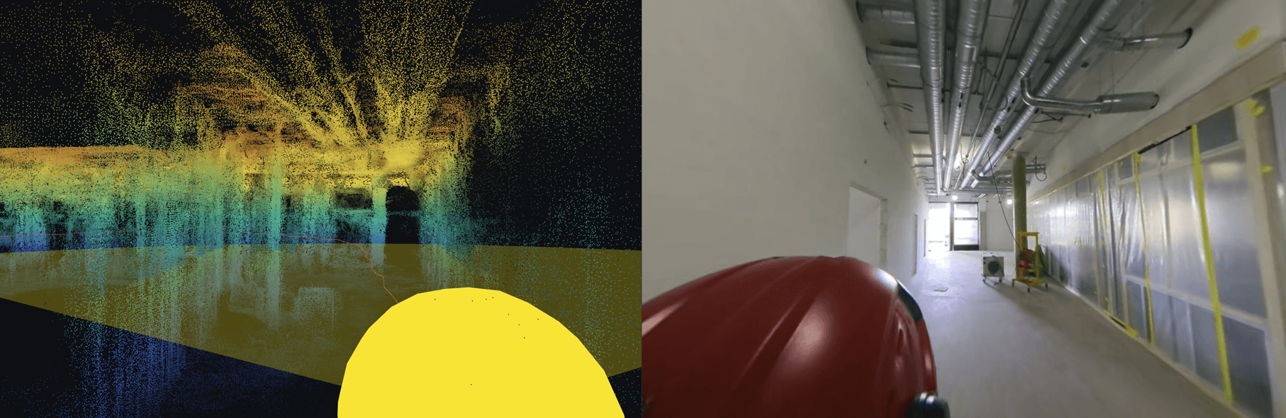
The question
Laser scanners are accurate but slow and expensive to send to every site visit. A 360° camera records a whole floor in a few minutes. The thesis asks which pipeline settings turn that video into a point cloud good enough to model from, and how to measure “good enough” when there is no reference scan.
The work was part of the Digital Twins of processes for construction of buildings project at Aalto University, funded by the Research Council of Finland. Supervisor: Prof. Juho Kannala. Advisors: Prof. Olli Seppänen and Inshu Chauhan.
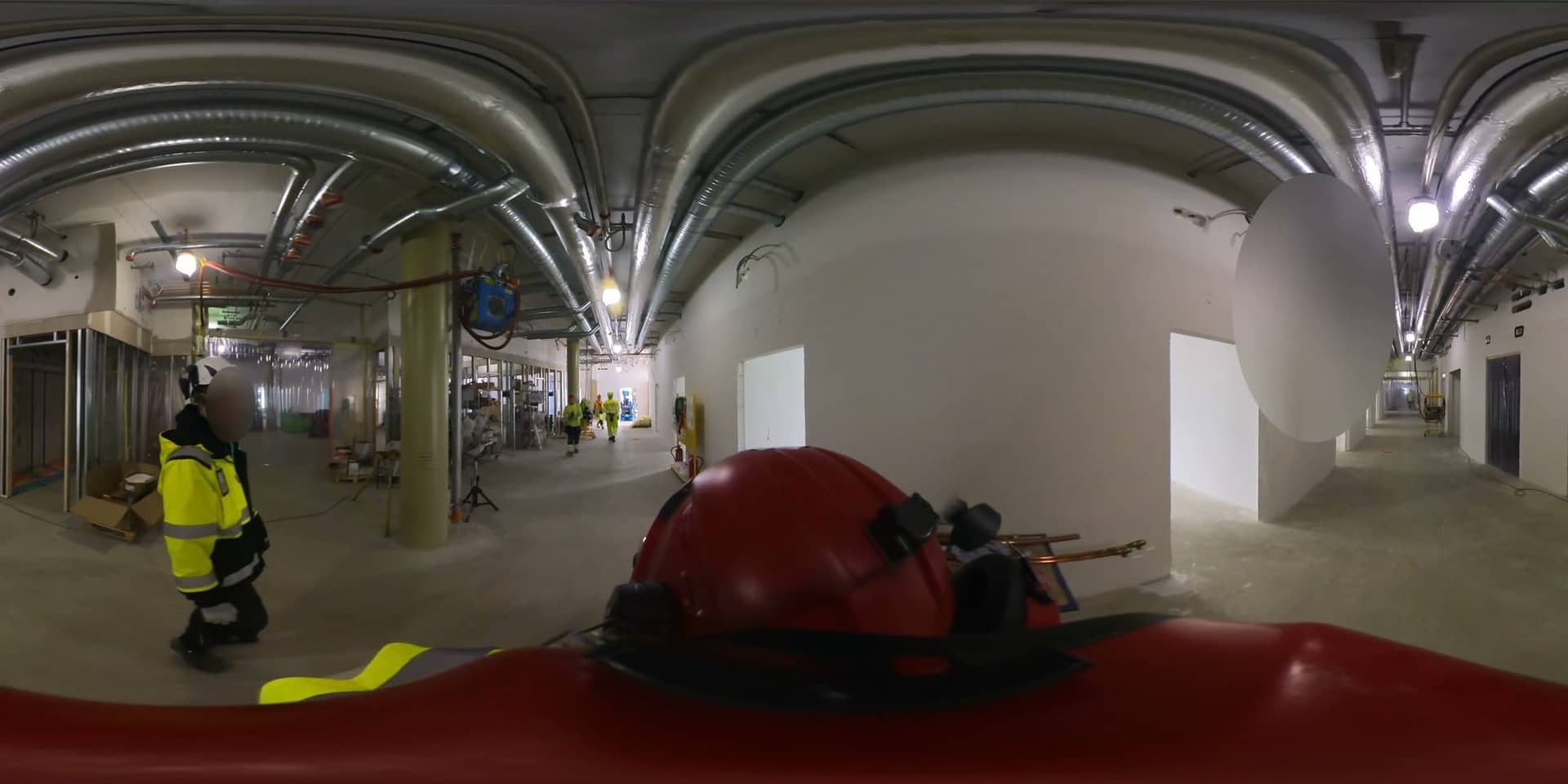
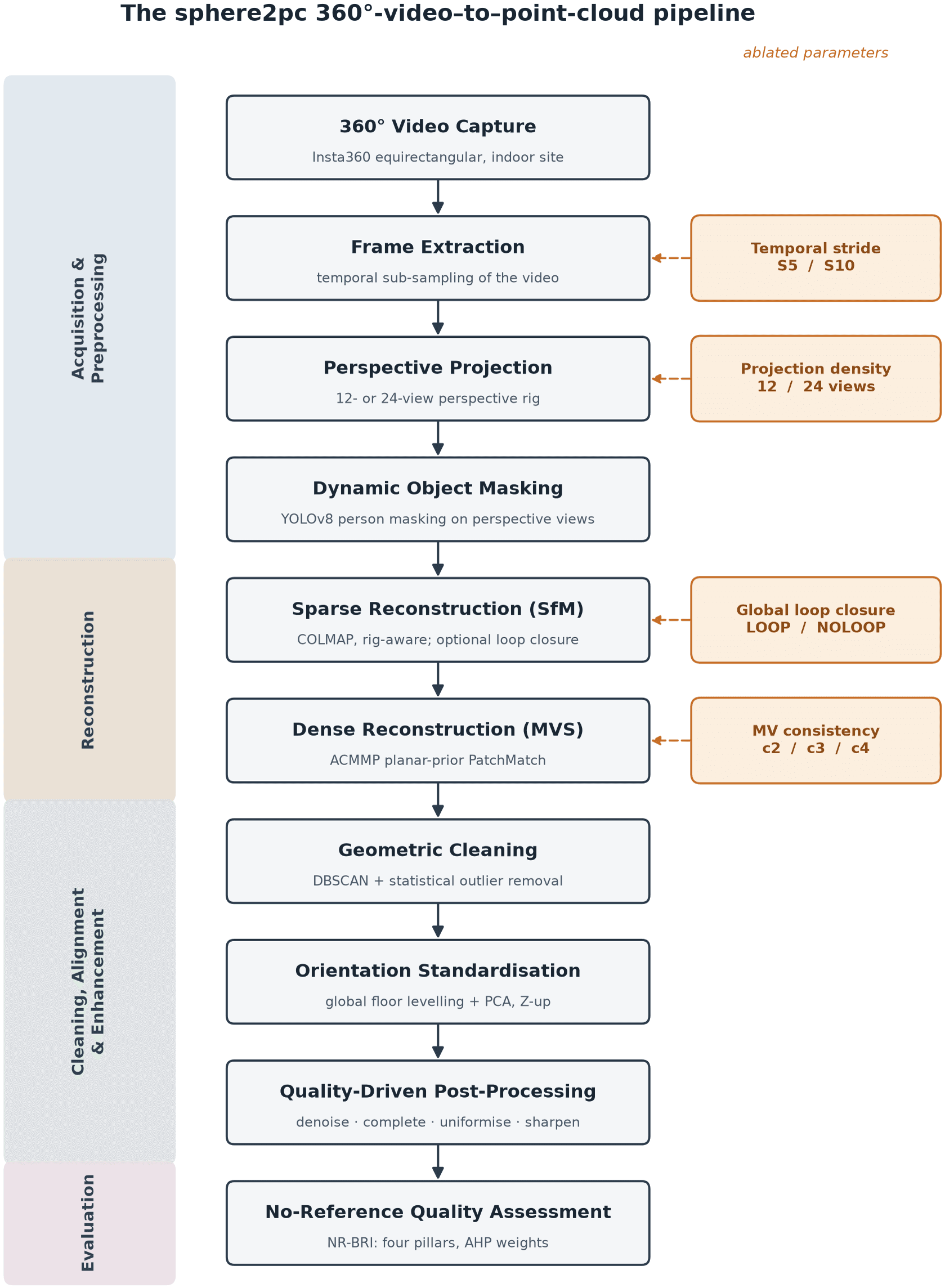
- 360° captureA walkthrough of a building under construction, recorded with an Insta360 camera.
- Frame extraction and projectionFrames sampled at a chosen stride and projected from equirectangular video into a 12- or 24-view perspective rig.
- MaskingPeople masked out with YOLOv8 on the perspective views before reconstruction.
- Sparse reconstructionCOLMAP structure-from-motion with the rig, with and without global loop closure (FAISS vocabulary trees).
- Dense reconstructionACMMP multi-view stereo turns the camera poses into a dense cloud.
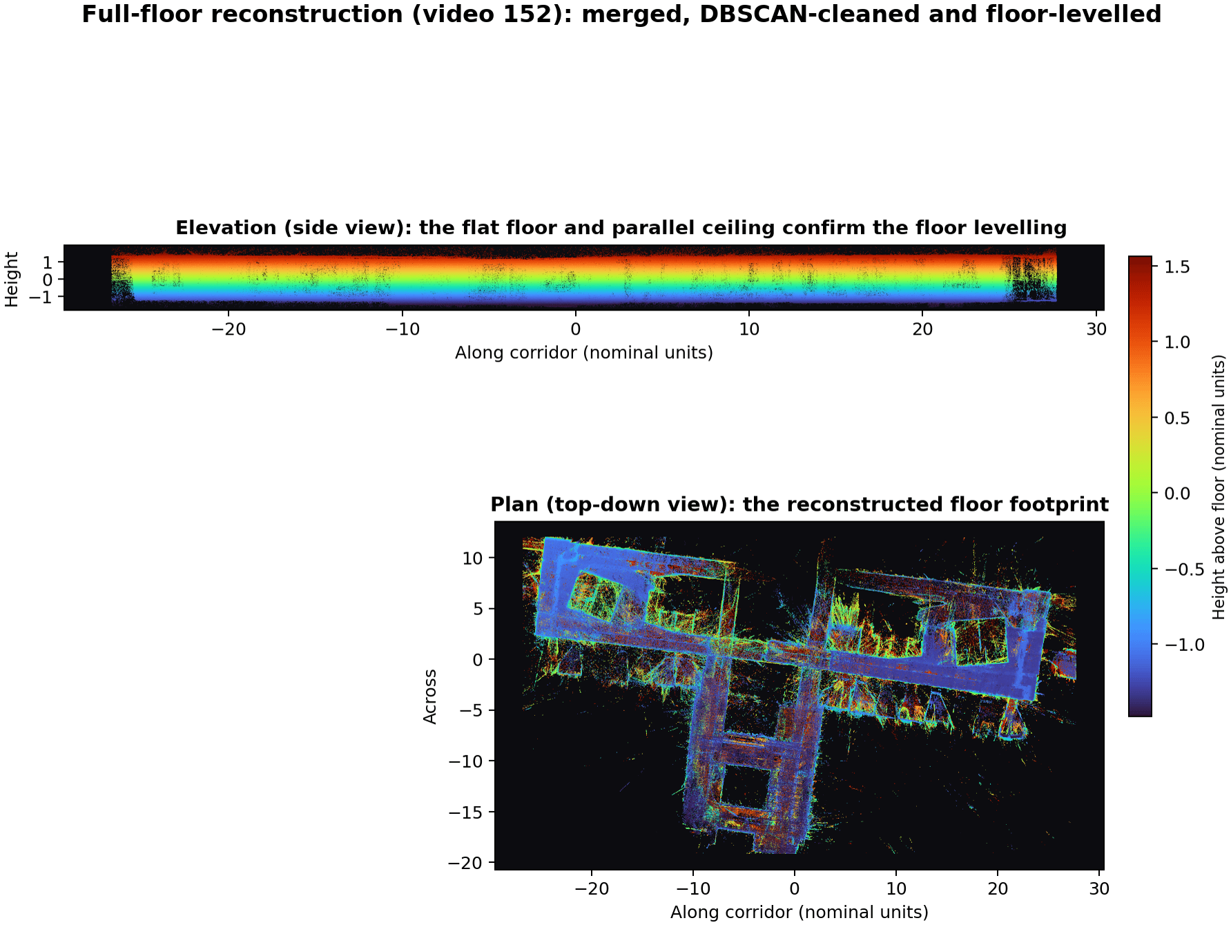
- Cleaning and levellingDBSCAN clustering and statistical outlier removal, then global floor levelling and PCA orientation to a Z-up cloud.
- Quality, without ground truthA no-reference score weighted with the Analytic Hierarchy Process: completeness, uniformity, sharpness and point density.
- SegmentationPoint Transformer v3 inference, checked against terrestrial and mobile laser-scanning control data.
What the ablation found
Twenty-four variants ran on Aalto's SLURM GPU clusters, varying frame stride, projection density and loop closure.
The clearest finding was about cleaning. Running DBSCAN clustering and outlier removal one after the other erodes the edges of walls and other structure, exactly the geometry BIM needs. Using DBSCAN as an intermediate step instead raised the BIM quality index by 22.8% over the baseline filtering.
Read the thesis on Aaltodoc: Optimizing a 360-Degree Video-to-Point-Cloud Pipeline for BIM Readiness: A Multi-Variate Ablation with No-Reference Quality Assessment.
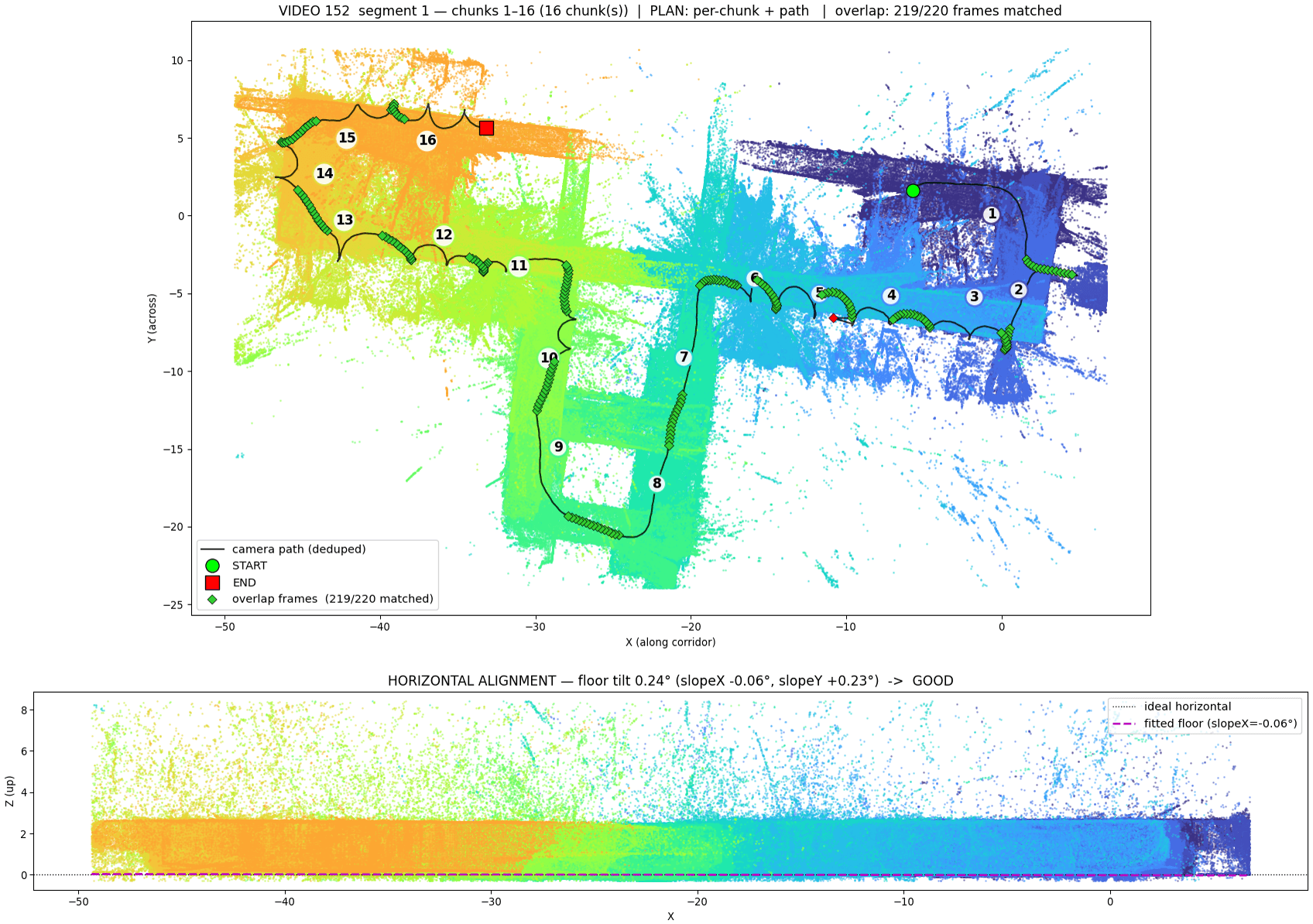
- COLMAP
- ACMMP
- Point Transformer v3
- PyTorch
- FAISS
- SLURM
- Python